Overview
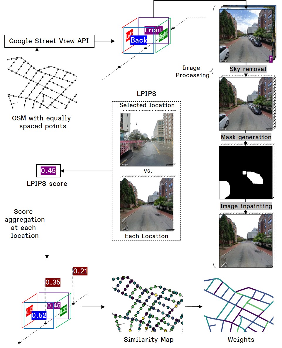
This study introduces a set of tools to quantify visual similarity between urban neighbourhoods using Google Street View imagery and deep learning techniques. It applies semantic segmentation and generative inpainting to preprocess and enhance street-level images, then employs the LPIPS perceptual metric to compute pairwise similarity and generate spatial similarity maps, providing empirical evidence on how visual sameness affects urban identity and monotony.
Key Features
- Leverages Google Street View imagery for high-resolution, street-level visual data.
- Utilizes semantic segmentation deep-learning models to parse scene components into meaningful classes.
- Applies generative inpainting to refine occluded or missing regions in street-view images.
- Computes perceptual similarity using the LPIPS deep-learning-based metric.
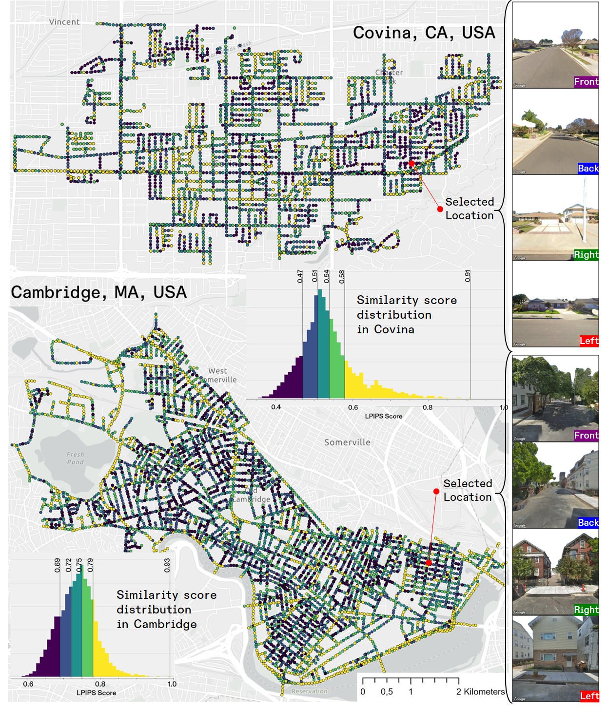
- Generates LPIPS-based similarity maps to quantitatively compare neighbourhoods.
- Provides empirical insights into urban identity, monotony, and their potential health impacts.
Gallery
Technologies/Data Used
Street View Imagery, LPIPS, Deep Learning.